South Jerusalem
The character of the border of the eastern areas of Jerusalem is unique, because it invites
and requires extensive negotiation between the two parties. Hence, we
have left many issues open for wide-ranging discussion. However, once we
move on to the South Jerusalem border—the first part of the segment
that extends from South Jerusalem to the Dead Sea—we have a section of
border where in most locales there may be clear view toward a mutual
agreement.
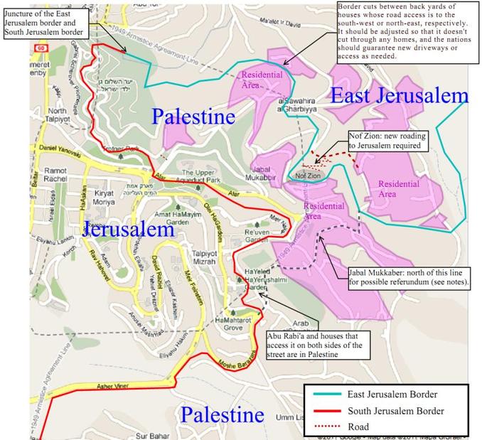
Jabal Mukabbir and East TalpiyyotWe propose that Palestine's border can
extend to the Armistice Line at the Peace Forest north of East
Talpiyyot, placing parts of the village of Jabal Mukabbir in Palestine.
The entrance to this area is but a narrow neck, which is now further
obstructed by the settlement of Nof Zion. We drew the border to keep
that settlement in Israel, but it will need a new access road to the
northeast.
Residents of Jabal Mukkabir living in said area northwest of a designated line, as shown on the map below, depending on the outcome of negotiations about East Jerusalem, may wish to hold a referendum to determine if they will become part of Israel or Palestine. The juncture of the East Jerusalem segment of the border and the South Jerusalem segment of the border is a point due south of the intersection of the unnamed north-south street just east of Abu Tor Street in Abu Tor, the 1949 Armistice Line, and the footpath into the Peace Forest. |
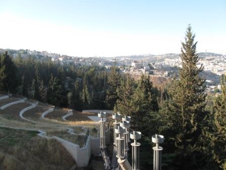
The South Jerusalem section of the proposed border of Palestine begins
in the Peace Forest, which forms the entrance to Jabal Mukkabir. While
this forest was established after the 1967 War to memorialize a peace
won by military conquest, in days to come the Peace Forest can become a
monument to the bonds of friendship between neighboring peoples who live
side-by-side in peace.
|
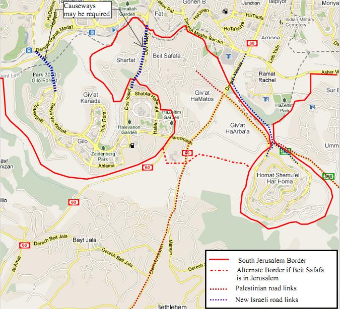
Gilo, Beit Safafa and Har Homa
Considering that Beit Safafa is a natural
suburb of Bethlehem, we propose giving it wide access to neighboring
Palestinian towns, including Bait Jala and Umm Tuba. Giv’at HaMatos is
largely empty at this time, and we believe that land could be used to
develop Beit Safafa’s infrastructure of access. This will also require
new access roads or causeways to Gilo and Har Homa, as Dov Yosef becomes
a street in Beit Safafa. A new intersection at the entrance of Har Homa
with underpasses and overpasses should allow for separate routes for
Palestinian and Israeli traffic.
While we are reluctant to assign Beit Safafa to Jerusalem, we include an alternative border which signifies that outcome.
Regardless, we believe the border should be managed by women who bring feminine values to make for comfortable and smooth crossings and to accommodate the large daily flow of traffic between Jerusalem to Bethlehem. We refer to this South Jerusalem border as the “Women’s Border,” because it is envisaged that committees of women from both Israel and Palestine might be established, to be consulted about the arrangements for border crossings and continually involved in their management. The close proximity of Jerusalem and Bethlehem necessitates a continually managed environment, where the needs of and conveniences for women and families have a high priority amidst other priorities. These needs will not be neglected if women are regularly consulted.
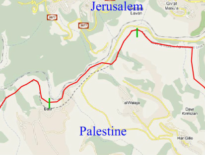
The "Women's Border"
The Women’s
Border stretches from the start of the South Jerusalem section to a
juncture marked north of al-Walaja, and then extends further to a
juncture marked just north of Batir. The extension requires more
formidable care, for here there has been a history of frustration, and
womanly intervention is anticipated to promote reconciliation. We call
on the women of Israel and Palestine to work to facilitate this.
It is hoped that in the future, as Jerusalem and Bethlehem and their environs expand toward the border, there will have been placed sufficient focus by both nations to assure peace. It is hoped that this Women’s Border will become a Peace Border, a border of reconciliation, and that it might also become a model for how to promote a peaceful border between Israel and her northern neighbors. |
|
